How national park status could affect Somerset Levels

 PA Media
Campaigners are calling for the Somerset Levels and Moors to become Britain's 16th national park – and the country's largest wetland. But what could this mean for the people who live and work there?
The Peak District became the UK's first national park in 1951, while the most recent, the South Downs, was given the status in 2010.
The Campaign to Protect Rural England (CPRE) hopes the Somerset Levels will one day join that list - but the process takes many years.
If the campaign is successful, what would it mean for residents, farmers, flood management and the local economy?
What are the levels?
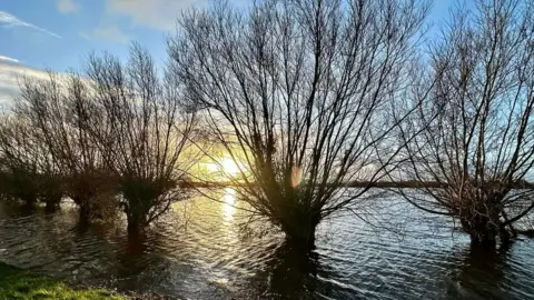
The Somerset Levels are a flat low-lying landscape covering about 170,000 acres (70,000 ha) across parts of the north and centre of Somerset in the West of England.
They stretch from Clevedon near Bristol in the north to Ilchester in the south, with Bridgwater Bay and the tidal Bristol Channel forming the western boundary.
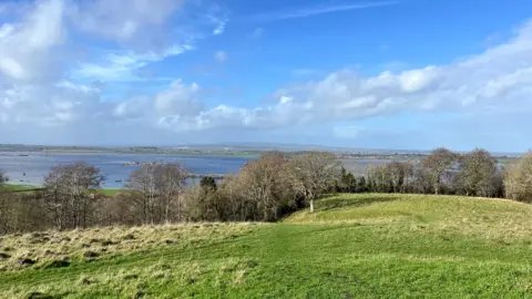
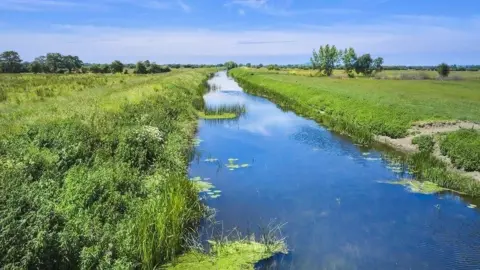
Thousands of years ago the area was covered by the sea. Today, it is a network of rivers and wetlands that has been drained, irrigated and modified to allow productive farming.
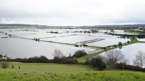
The levels are the UK's largest lowland wetlands and are used as flood plains during the winter to help protect towns and villages across Somerset.
What does national park status mean?
 Natural England
National parks are protected landscapes funded by the government and managed by National Park Authorities (NPAs).
There are currently 10 parks in England, three in Wales and two in Scotland. They include the Lake District, Dartmoor, Exmoor and the Yorkshire Dales.
NPAs have a legal duty to conserve and enhance natural beauty and wildlife, while also supporting the economic and social wellbeing of local communities.
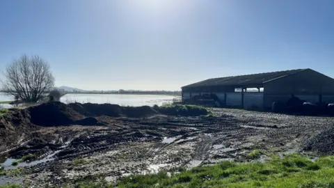
What about flood management?
Earlier this year, the government announced £89.9m would be spent on flood prevention measures in Somerset to help protect homes and businesses.
About £6.1m of that will be allocated to a Somerset Levels and Moors pump replacement programme.
It is currently unclear how national park status would affect flood management plans in the area.
The Environment Agency, Drainage Board Association and Defra said they could not comment at this early stage of the campaign.
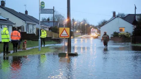
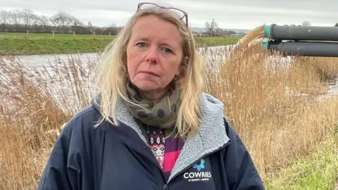
Local resident and flooding campaigner Bryony Sadler said she fears national park status could make it harder for flooded residents and businesses to access support and pumping equipment.
"Unless someone comes to us with a money solution so that we can have an upgrade to a pumping system and do some work to make the infrastructure on the Somerset Levels better - I don't want any more hassle to try and get rid of the water," she said.
"We don't want to be a reservoir. We don't want water sitting for weeks and weeks on end when the forecast is for endless rain."
How could it affect farmers?
The CPRE has suggested national park status could help tackle phosphate pollution, soil erosion, flooding and peat loss through financial farming support schemes.
In England the £100m Farming in Protected Landscapes (FiPL) programme provides funding for farmers and land managers working within national parks and other protected landscapes.
However, FiPL is not currently available to farmers in the Somerset Levels because the area does not have national designation.
A National Farmers Union (NFU) spokesperson said: "Farmers and growers are at the heart of the landscape from which they are proud to produce high-quality food and they remain its custodians, managing the countryside, which has been shaped by generations of farming families."
The union said it would wait for more detail before discussing the proposals with its members.
What could it mean for residents?
Sadler said the campaign has not "got much traction" with residents so far.
"I just don't think the campaign is far enough forwards and there are questions that need answering first," she said.
"I get that people want it to be a special place - it is - but someone has got to find a way of making the infrastructure better than it is."
She added that CPRE campaigners needed to "work together" with residents.
"Let's have a discussion," she added.
How could it affect the local economy?
According to the Campaign For National Parks (CNP), the status would protect the Somerset economy through tourism and local business growth.
"The association with the National Park could also enhance the branding of farm products and allow farmers to market their goods at a higher price," CNP said.
CNP has also argued that the designation could help protect the Somerset Levels from ad‑hoc developments, such as large solar farms – a controversial issue for some residents that live near current and prospective developments raising concerns around noise pollution, the effect on wildlife and house prices.
What happens next?
The CRPE has launched a survey to find out what the Somerset Levels mean to people and is set to host a public discussion on whether the area could become our next National Park.
The free event will take place at Glastonbury Town Hall on 1 October.
Somerset Council has been approached for a comment.
Follow BBC Somerset on Facebook and X. Send your story ideas to us on email or via WhatsApp on 0800 313 4630.
