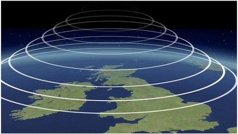
Monthly Outlook

- Published
Temperatures are likely to stay above average in most areas through the rest of this week, and rise higher next week, with a lot of dry weather. Occasional rain will mostly affect northern areas.
The following couple of weeks should see high pressure dominate, with temperatures above or well above normal at times, so some hot days are possible away from the north.
Tuesday 30 June to Sunday 5 July
Wet at times in the north. Becoming warmer
A few scattered showers will develop on Wednesday but southern England and Wales should have a lot of dry weather. A low pressure system passing to the north-west of the UK will bring widespread wet and windy weather to Northern Ireland and Scotland through the afternoon. Its associated front will take a band of rain into northern England and Wales overnight but that will weaken as it moves farther south-east, leaving mostly fine conditions on Thursday across the UK, aside from isolated showers.
High pressure will build across the southern UK, and most of England and Wales will be dry throughout the rest of the week, with some sunshine and gradually increasing warmth.
Scotland and Northern Ireland will have further outbreaks of rain, and some showery outbreaks will occasionally get into northern parts of England and Wales.
Temperatures will be near average in the northern UK but above in most areas, and could reach the at least the mid to high 20s Celsius in some central and southeastern regions.
Monday 6 to Sunday 12 July
High pressure will dominate
Next week conditions should be dominated by high pressure, especially during the first half of the week when it may build farther north. That will lead to largely dry weather across the UK, although occasional rain or drizzle could affect parts of Northern Ireland and Scotland, especially western areas. That will keep temperatures a little subdued, although perhaps a little above normal, but warmth and heat should strengthen elsewhere.
Temperatures should exceed 30C in parts of the central, southern and eastern UK, perhaps reaching the mid-30s in places.
During the second half of the week high pressure could weaken for a while and allow a front to drift across more of the UK. Any rain should become fragmentary but a few heavy showers are possible with the risk of isolated thunderstorms. There will still be sunshine in between, and a fair amount of dry weather, but daytime temperatures may come down by a couple of degrees, although should still be above to well above normal.
Monday 13 July to Sunday 26 July
Probably warmer than average. Possibly hot
The outlook through and beyond mid-July has a lot of uncertainty, with longer range models diverging and having weakening signals as far as the pressure patterns are concerned, and diverging considerably. High pressure should still be the predominant feature but its position is rather uncertain.
We may see high pressure anomalies shifting to more northern latitudes for a while through mid-July, but this may have similar impacts on temperatures, and pressure may build across Scandinavia as well.
Most of the UK should be warmer than normal, with the strongest heat likely to be across parts of England and Wales. Temperatures could rise above 30C again in places, and potentially well above. There may be increasing chances of showers or thunderstorms, but rainfall amounts are most likely to be near or below average overall.
Slightly cooler conditions are possible if an Atlantic high pressure ridge also stays in place or redevelops. Even then temperatures would still most likely be near to above average.
Further ahead
In Friday's outlook we will look again at the possibility of heatwaves returning to some areas, and glimpse towards the end of July and start of August.
- Published1 May
- Published22 June

- Published7 April 2022