Liz Bonnin introduces clips that explore how a river changes as it travels downstream.
Video
Liz Bonnin: Hi, I’m Liz Bonnin. It’s impossible to talk about how television has helped our understanding of the Earth and nature without including the godfather of wildlife broadcasting, the great Sir David Attenborough.
Here we have one of his famous reports from around the world, looking at rivers, how they can change as they move over land, and how they can be so powerful that they alter landscapes as they flow through them.
There are a couple of rivers David mentions in this clip but the focus is on the biggest of them all, the Amazon. He starts in the shadow of the Andes mountain range and follows it over almost 4,000 miles from source to sea.
David Attenborough: The many sources of the Amazon began as numberless rivulets on the eastern flanks of the Andes. Now, 5,000 feet lower down, each has grown beyond recognition and cut its own zig-zag valley. White water tumbling down the valley wall joins the brown water of a larger tributary, heavy with mud and sediment.
And as it gets bigger and bigger so it becomes more and more powerful. It’s the dry season at the moment, and the river is comparatively low. But during the rains, when it’s in spate, its water’s rise up over here and the sheer volume and weight and force of them can shift boulders the size of these.
The volume and speed of its waters are not the river’s only weapons. It also has teeth. And this empty, rainy season part of its bed, you can see them. Sand and gravel. Fragments of rock that have been eroded from higher up in its course and which the river hurls with enormous force at the rocks of its river bed.
With such tools, it can carve away the sides of mountains.
Young, vigorous rivers transform the land. Demolishing the mountains, breaking down the debris into smaller and smaller particles and carrying them away downstream.
This river in China is perpetually so turbid that it’s called the Huang He, the Yellow River. It carries a bigger load of sediment than any other river in the world. During floods, each cubic yard of water contains over two thousand pounds of soil and pulverised rock.
Rivers in the full vigour of their youth are terrifyingly strong. They roll great boulders along their beds, they cut away at the banks, undermining trees which crash into the waters and are swept away.
When a river encounters a band of unusually hard rock, such as an ancient flow of basalt lava, its progress is temporarily slowed. It spreads out across the barrier and then tumbles over the front edge. So are formed some of the loveliest cascades.
These are the falls of Iguazu, on the border of Brazil and Paraguay. They can’t compare in height with the Angel Falls, but in terms of the volume of water that passes over them they are incomparably bigger.
The falling waters pound away at the base of the falls undercutting the basalt until blocks split off the face. So the falls steadily work their way up river leaving downstream a deep gorge.
And now the river has left the mountains far behind, and has changed its character considerably. It’s bigger. It’s broader. And its waters carry not only sand and gravel but rich nutrients that have washed in from its vegetation-covered banks.
And after it’s gone over its last rapids and tumbled over its last fall, it becomes a very different river indeed.
As the river gets older, it slows down. A minor obstacle in its path is now enough to deflect it. The water flowing round the outside of a bend has to travel farther and speeds up and cuts away at the bank.
On the inside of the bend, where the current is slow, the water can no longer support its load of sediment and drops it to form a shoal. So the bend becomes more and more exaggerated as the elderly river swings from side to side in a series of loops and meanders.
In places, one bend may approach another until the neck of land between the two is so narrow it collapses. Then the river takes the shorter course and the meander is left isolated as a curving lake. There the water at last is still.
Liz Bonnin: In the Amazon, those bodies of water are relatively small, but some rivers flow into basins created by geological faults and there the water collects to form huge lakes. When this happens, these rivers slow down and deposit their sediment.
David Attenborough: The Amazon has no great lake on its course, so even in its middle stretches, it still carries mud from the Andes. The Rio Negro, which joins it here, is clear, for it has come from the north west where the rocks are hard and bare.
The two immense rivers flow for miles alongside one another in the same bed, scarcely mixing. As well as sediment they also carry abundant nutrients.
In the last phase of their lives, these great rivers often flow out of control. Their tributaries, far away in the mountains, fed by the heavy storms of the rainy season, pour so much water into them that they burst their banks.
The Amazon rises every year to flood tens of thousands of square miles of forest. In some parts, as much as 40 feet deep.
Some of these trees are flooded for eight to ten months every year. They need only a couple of months annually out of water for them to grow and for their seeds to germinate and sprout. We still don’t know exactly how they manage it.
As the river becomes older and older, its riches increase still further. All over the world, as rivers approach their end they begin to deposit the sand and mud that they’ve gathered for so far and carried for so long.
In many parts of the world, reeds grow thickly on these shoals and banks, and their stems collect even more sediment as the river waters swirl through them.
Of all the deltas in the world, none is greater than that of the Amazon.
For hundreds of miles along its lower course the river has been so broad that it has been impossible to see from one side to another. Now, instead of receiving more tributaries, it splits into a tangle of separate channels.
And on the last firm land on its banks stands a great and thriving port. For the river is so wide and deep that cargo ships form overseas can use it as a highway that can take them for 1,000 miles into the heart of South America.
The Amazon’s vital statistics are astounding. At any one time, two thirds of all the river water in the world is flowing between its banks.
Here at its mouth, Belem, it’s two hundred miles across, a maze of channels and islands, one of which is alone bigger than the whole of Switzerland.
And the river maintains its identity until far out into the sea. It was because of this that it was discovered. In 1499, a Spanish sea captain sailing well beyond the sight of land suddenly became aware that the water he was crossing was fresh and not salty. And he turned west and discovered this immense river.
Indeed, it’s not until 100 miles beyond the edge of the continent that particles of water which fell on the Andes complete their 4,000 mile-long journey and mingle with the salt water of the ocean.
Liz Bonnin: One of my favourite parts of that clip was where David spoke about those two rivers flowing side by side. It just looked amazing.
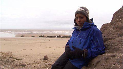
Now that was filmed over 30 years ago, but Helen Skelton got to experience it too when she kayaked down the Amazon for Blue Peter, a little more recently, in 2010.
Helen Skelton: The Amazon has over 1,000 feeder rivers, or tributaries. The biggest is the Rio Negro. And the point where it joins the Amazon is an incredible sight.
One side of my kayak, the water is dark and one side is brown.
The Negro is darker in colour, its water thicker, warmer and slower than the Amazon itself. As a result the two rivers run side by side without mixing properly for nearly ten miles.
What? This is so weird, it’s sort of all swirly and … bubbly almost.
Download/print a transcript of the video.
Liz Bonnin introduces BBC archive footage of Sir David Attenborough as he follows the Amazon River downstream.
Sir David explains how the characteristics of a river change and how dramatic scenery results from the erosion of rocks. He also explains how waterfalls form in the upper course of a river and meanders are found in the lower course. The formation of ox-bow lakes is also shown.
Sir David references the Yellow River in China as well as other major rivers around the world.
The film ends with Helen Skelton describing the confluence of the Amazon and its main tributary, the Rio Negro ('Black River' in Spanish / Portuguese).
Teacher notes
Download/print the Teacher Notes for this episode (pdf).
Before watching the video
Look at a map of the world to locate the Amazon and the Yellow River. Ask students to write a locational description of where they are located and which countries they run through. Students could also predict which river they believe to be longer.
As a class you could also discuss rivers local to you, what landforms can students name and which course of the river are they in. A comparison could be made between a local river and the two rivers in the clip.
Introduce key terms such as:
Rivulets: A small stream of water.
Tributary: A small branch river which joins onto a main river.
Turbid: Cloudy or opaque water
Meander: A bend in the river.
During the video
You may wish to stop at relevant points during this short film to pose questions and check understanding or wait until the end. Useful questions might include:
- Describe the Amazon River.
- Describe the Yellow River.
- How is a waterfall formed?
- What happens on the inside bend of a meander?
- What happens on the outside bend of a meander?
- What happens when a river is slowed?
- How deep is the Amazon River in places?
- How many tributaries does the Amazon River have?
- Why do the two rivers not mix properly?
After watching
Look at the full length of a river from the upper course to the lower course and the landforms that can be found such as waterfalls, gorges, meanders and deltas.
Task students with drawing a river channel from source to mouth and label the different landforms. Students could then look at the Bradshaw Model and what is expected to happen as you move downstream – for example how the width and depth change. This knowledge could then be applied to different rivers around the world to see which rivers do fit the model. Remember, that a model is just a representation of what rivers could be like.
Create a glossary of the key terms associated with rivers, this terminology could be separated into landforms and processes.
Where next?
Use GIS (Geographic Information System) to visit rivers around the world and to investigate how they change from source to mouth.
Tools within GIS allow you to measure the width. 3D layers can be added to show the relief of the land and enable students to see the variety of landforms in more detail.
Curriculum notes
This topic appears in Geography at KS3 (Hydrology) and KS4 / GCSE (Rivers and water) in England, Wales and Northern Ireland and National 4/5 in Scotland.
Curriculum notes
What is the water cycle? video
Iain Stewart describes the water cycle including evaporation, condensation and precipitation.
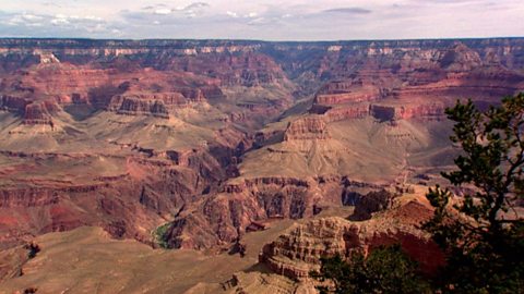
The erosion of the Grand Canyon. video
Liz Bonnin introduces the Grand Canyon - its ancient geology and what can be learned from the erosion of the rocks.
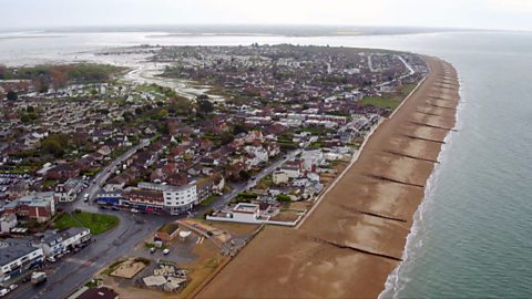
What coastal management techniques are being used on Hayling Island? video
Introduces the coastal management techniques used on Hayling Island in Hampshire to control drift and flooding.
What is a ‘spit’ and how does it form through longshore drift? video
Katie Knapman explains how a spit forms through longshore drift and is a dynamic physical process, constantly changing the coastline.
The geology of the Jurassic Coast. video
Exploring the Jurassic coastline and its geological significance with rocks spanning the Cretaceous, Jurassic and Triassic periods.
How have physical processes impacted the landscape of Yorkshire? video
Julia Bradbury explains the formation of Malham Cove including limestone pavement, highlighting the impact of glaciers on the landscape.
Glaciation and the UK coastline. video
Alice Roberts explains how Britain was once connected to Europe, but changed due to rising sea-levels following the Ice Age.
How has glaciation shaped the landforms of the Northern Hemisphere? video
Iain Stewart explains the glaciation of the Northern Hemisphere, focusing on the Yosemite Valley in California.
What evidence is there for climate change in the UK? video
Tom Heap considers the evidence that the UK climate might be changing - with more droughts, higher summer temperatures, but wetter winters.
How can plate tectonics impact oceans? video
Exploring how the plate tectonics impacts the coastline, focusing on California through study of the San Andreas fault.
Plate tectonics in the UK - Anglesey. video
Nick Crane explores the geology and seismology of Anglesey - earthquake hot spot of the UK.
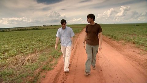
Deforestation and the growth of soya in Paraguay. video
Simon Reeves visits Paraguay to consider the deforestation that has occurred there to grow soy and the challenge of conservation vs development.