Changing times on the nature reserve 'at the end of the world'

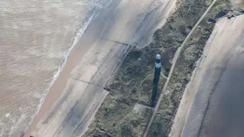 English Heritage/Getty Images
David Craven often jokes to people about how to get to Spurn Point.
"You drive through Hull and carry on till the end of the world," he says of the remote peninsula at the tip of the East Yorkshire coast.
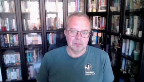
Craven works for the Yorkshire Wildlife Trust (YWT), which is celebrating 30 years of the Spurn nature reserve.
During that time, the trust has had to deal with the tides of change, from days when residents would hang out their washing outside a neat row of homes, to allowing nature to reclaim the area.
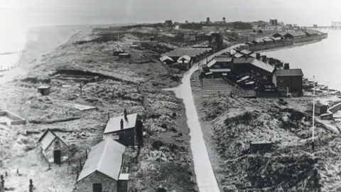
 East Riding Archives and Local Studies
Spurn juts out 3.5 miles (6km) into the Humber Estuary, a curving spit of sand, mud and marram grass which, in places, is just 160ft (50m) wide.
In 2013, a tidal surge breached the peninsula and destroyed part of the road that runs down its spine.
Then in 2025, the RNLI left its lifeboat station there after two centuries because of ageing infrastructure.
It means the fate of Spurn now lies in the hands of YWT and the elements.
Described as one of the "most charismatic" reserves by the trust, the site can be unpredictable.
Since 2013, David says managers have had to plan around the tides and "rapidly adapt" how to use vehicles to access the headland.
Change is not new, however.
Over the centuries, many communities have been lost to the sea along this unique stretch of coast, including the towns of Ravenser Odd and Ravenspurn.
Then, during the 19th and 20th centuries, the headland was taken over by the military and became home to huge gun emplacements and other defences, the remains of which can still be seen today.
 Corbis via Getty Images
Traces of the last permanent inhabitants remain, with a chalk "football crowd" drawn on to a wall where local children used to play.
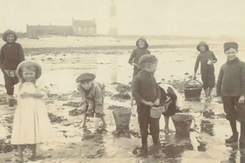
"The biggest change has been the slow exodus of people from Spurn," David says.
"There was a point when you went there you would have a railway line, a school, a pub and people doing their washing.
"It's now about allowing the site to be itself and do what it wants to do and see where that leads us."
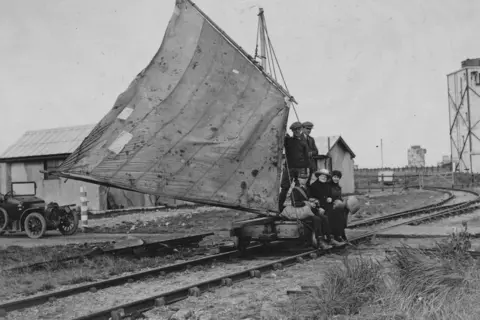
 East Riding Archives and Local Studies
Efforts to establish a nature reserve at Spurn began when a forerunner to the trust purchased the land from the government's war department for £1,500 in the mid-1950s.
It became a designated national nature reserve in 1996.
Initially, YWT took a "people-centred approach" because of the people still living there, but now it can focus on allowing nature to thrive.
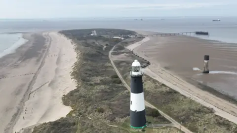
 Getty Images
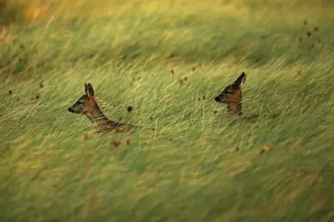
The site, which includes salt marshes and sea grass beds, is currently home to ground-nesting birds and various species of migratory birds that come and go.
And in the wake of the 2013 breach, nature is working hard to repair Spurn through a coastal process known as longshore drift, which may lead to changes in the shape of the peninsula.
"We think the point will still stay there but the middle will sway around a little bit over time," David says.
"It will be fascinating for people managing this long after I've gone."
Having visited Spurn since being a young boy, David speaks fondly of the unique peninsula.
"Every day I go there it will always present things I've never seen before," he says.
He also believes is one of the best places in the country to see sunrises and sunsets.
"You can be standing there watching the sunset and a barn owl will come flying past, or you'll see tens of thousands of wading birds moving across the Humber.
"It doesn't matter that you might have bad days or challenges, you're always going to come back to that sense of being in a place that is wonderfully beautiful.
"That is Spurn. It throws the unbelievable up as reality."
Listen to highlights fromHull and East Yorkshire on BBC Sounds, watch the latest episode of Look North.
Download the BBC News app from the App Storefor iPhone and iPad orGoogle Play for Android devices
